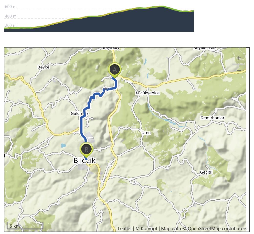
Vezirhan to Bilecik – 12th September
Distance: 16.5 km – Elevation +500 m -130 m
Weather: Sunny. Temperature: High 28 degrees
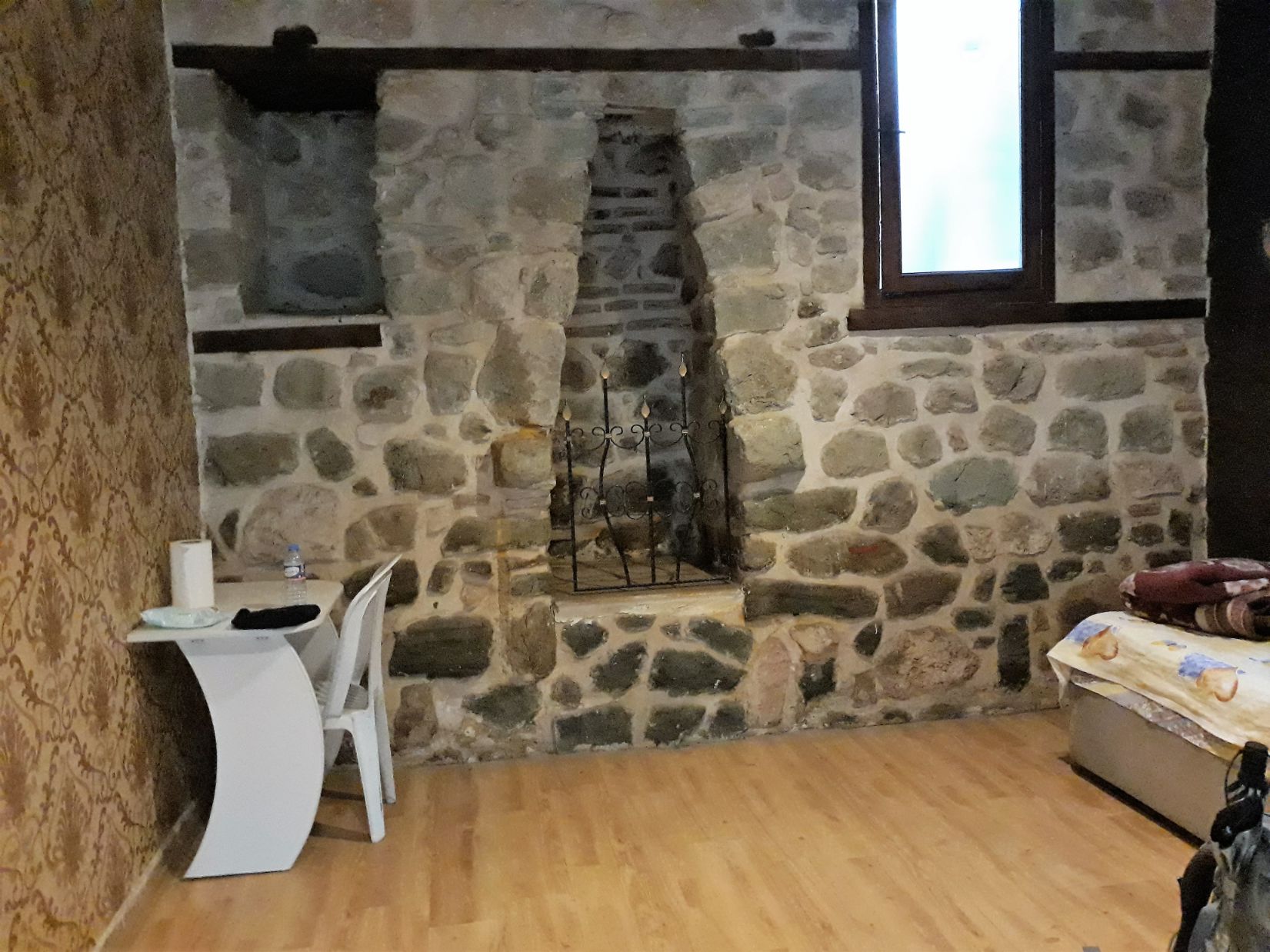
The Vezirhan Inn where I stayed last night was built in the 16th century as a caravanserai, an ancient roadside inn. Caravanserai were built along all the major trade routes that linked Asia, North Africa, and southeast Europe. Vezirhan is a small town and the population is mainly of Greek origin predominantly from Thessaloniki. This was a result of the 1923 population exchange between Greece and Turkey whereby all the Greek Orthodox peoples in Turkey were forced to move to Greece and an equal number of Muslim peoples in Greece were forced to move to Turkey, neither had a choice!
I had planned a relatively short walk today of around 10 miles so there was no need for an early start. I left the caravanserai at 8.00 am and walked to the town centre for breakfast. After breakfast, as I was walked around taking in the local sights, a small group of men sitting outside a shop invited me to join them for a cup of tea ( note cup and not glass) and as always with the aid of Google translate and a map of my journey to Konya they understood why I was in Vezirhan.
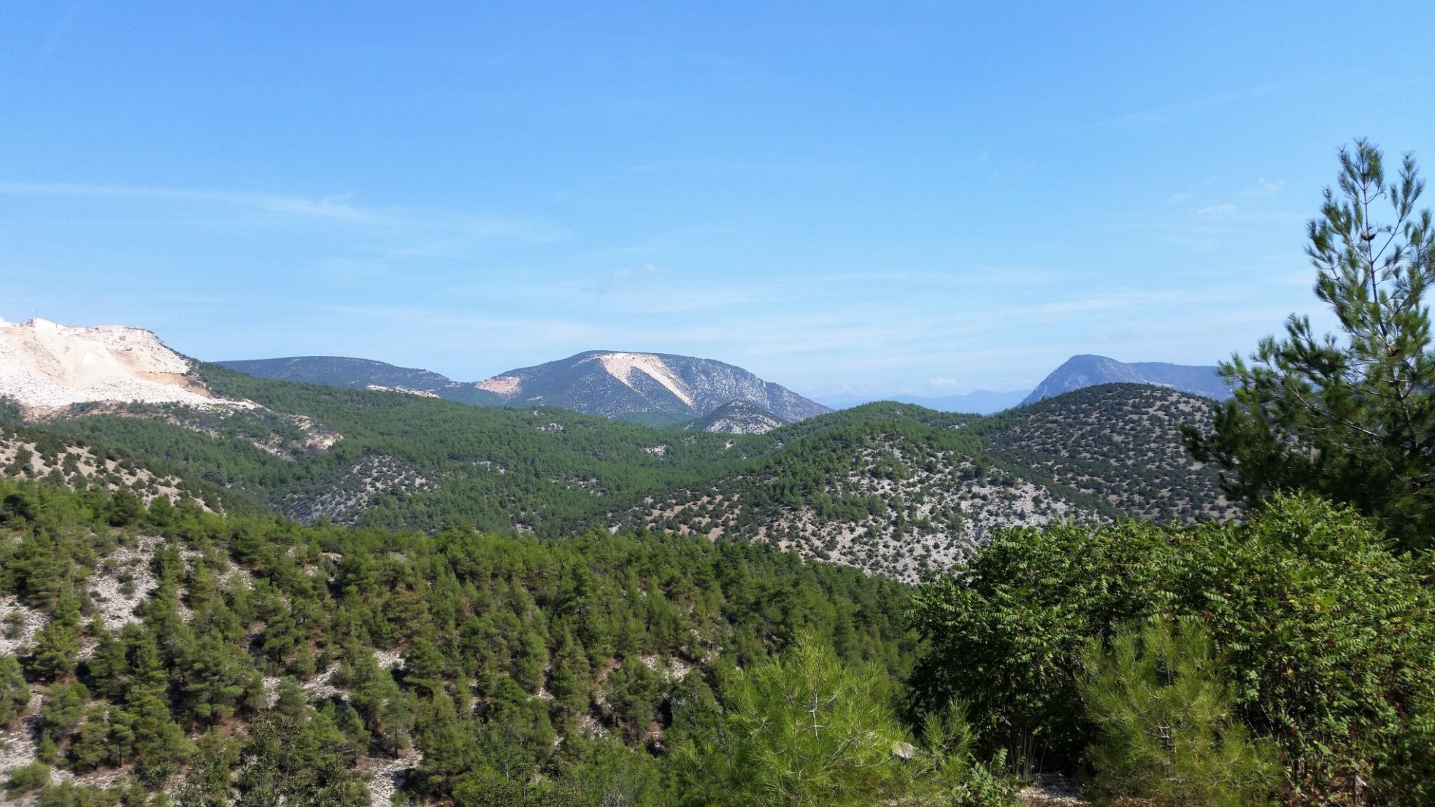
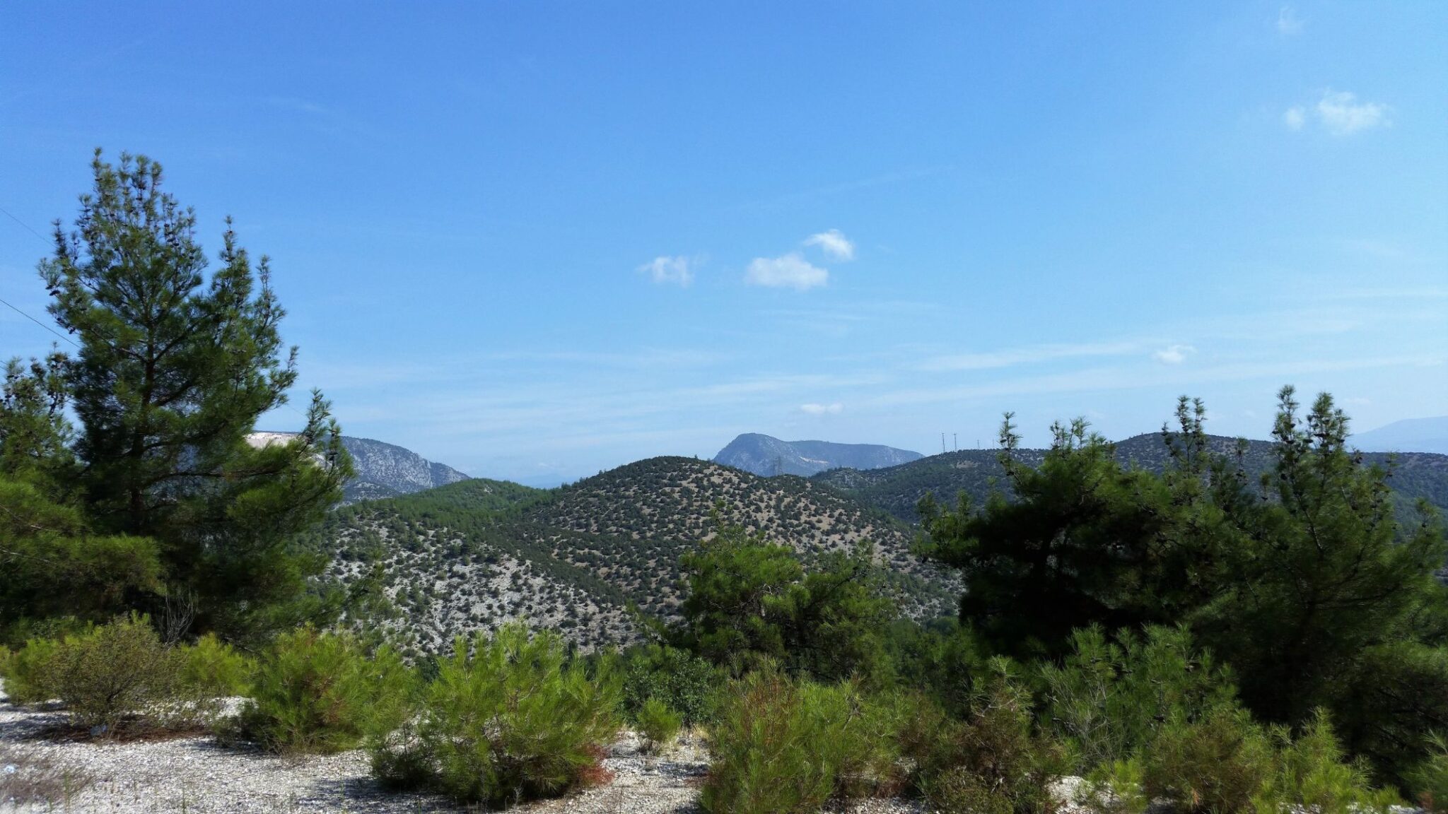
I had decided to take the relatively quiet Adapazari Bilecik Road which ran the whole distance between Vezirhan and Bilecik. It wasn’t long after leaving the town that the road began to climb and this climb would continue for the next 11 kilometres rising from an elevation of 200 metres to 650 metres. It was a beautiful morning and temperatures rose throughout the day peaking at close to 30 degrees. A tractor and trailer trundling up the hill stopped and the driver kindly offered me a ride and seemed rather mystified when I declined his offer.
There are several marble quarries in this area and I passed by one as I continued the climb:
Vezirhan breccia quarry
This rock is a monogenic calcareous breccia quarried in ancient Bithynia, near Vezirhan (Bilecik, Turkey) and not far from the important river Sagarius (now Sakarya) that gave the name to the stone. The breccia consist of angular, white-rose clasts of varying size resting in a compact matrix, of which there are several chromatic varieties; pink, bright coral red (hence the name breccia corallina) and brown. The stone was probably introduced to Rome in late Augustan times, and was used until the end of the Empire, predominantly for medium-sized columns, tondi, wall and paving slabs, etc. The quarries are well preserved and display frequent marks from the ancient quarrying techniques on the vertical quarry faces.
Text by Lorenzo Lazzarini
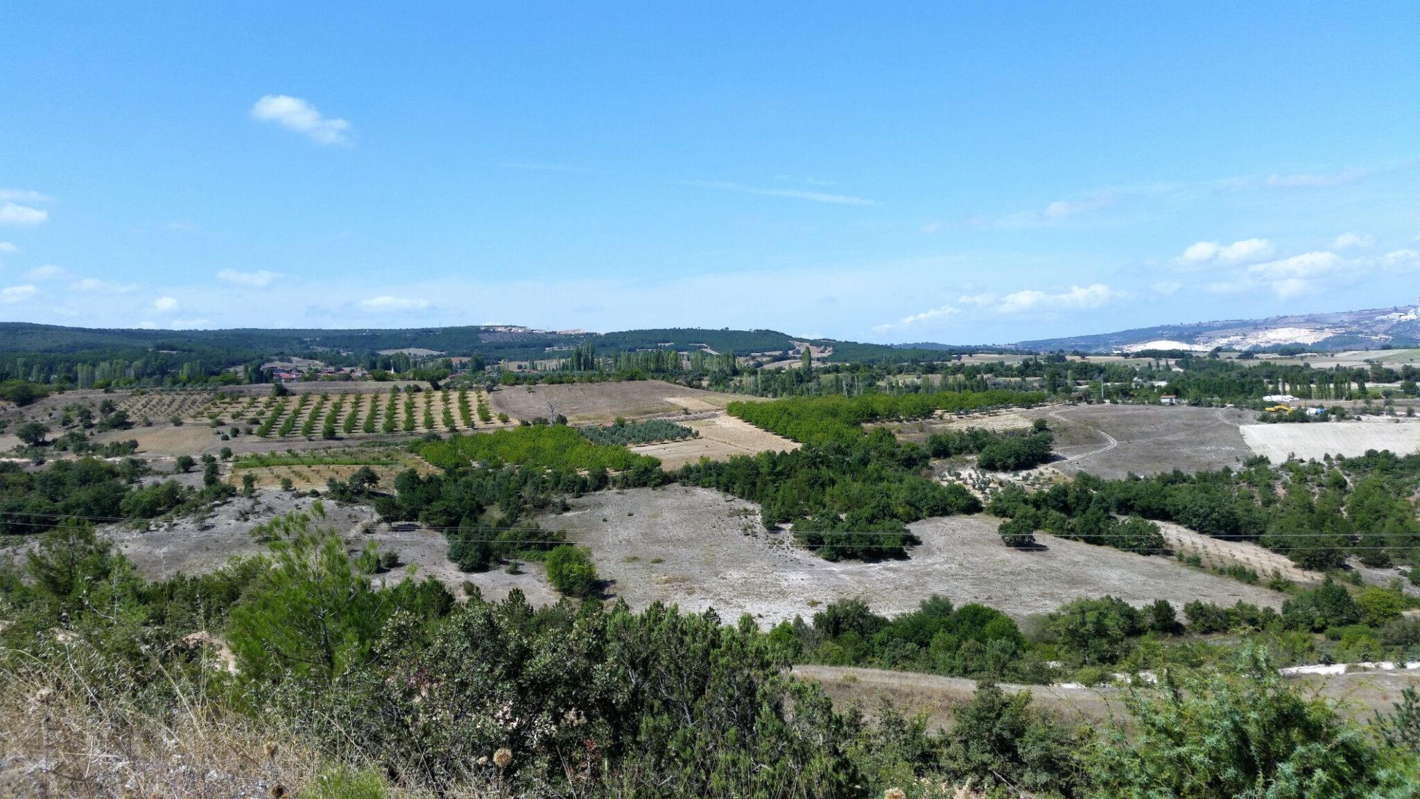
As the road continued to climb between Karadag (Black mountain) and Gülümbe dag, the views to the surrounding mountains were very beautiful, and around halfway close to the village of Gülümbe I called into a roadside filling station and purchased snacks and drinks for a later lunch. I passed by the village of Gülümbe where the blue-tiled spire of the Ulu Cinar Mosque minaret rose elegantly, standing out from the backdrop of the distant mountains as it mingled with the treetops almost as if it had grown naturally.
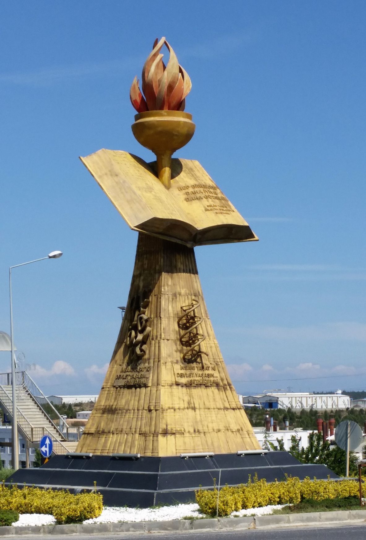
Eventually, close to 14 kilometres into my day’s walk the road began to descend and I passed by the campus of the Bilecik Şeyh Edebali University with its impressive monument with its open book proclaiming “Hep birlikte daha iyiye daha güzele“ which translates as “Get better together” and its main inscription, quoting Sheikh Edebali “İnsani yaşat ki devlet yasasin” which translates as “Let the people live so that the state can live”.
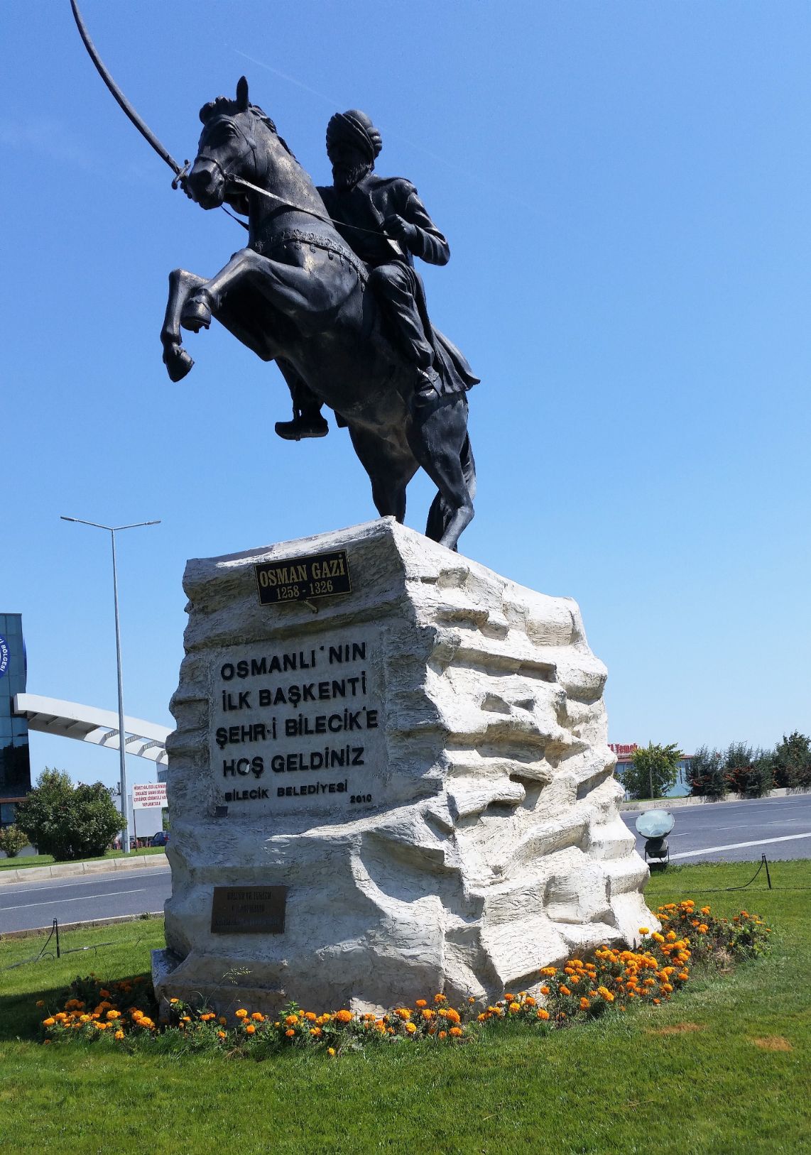
Approaching Bilecik I was welcomed by the statue of Osman Ghazi, who was the leader of the Ottoman Turks and the founder of the Ottoman dynasty. The statue was erected by Bilecik Belediyesi in 2010 with the inscription “Osmanli’nin ilk baskenti sehri Bilecik E hoşgeldiniz” which translates as “Welcome to Bilecik, the first capital city of the Ottoman Empire.”
On the outskirts of Bilecik, I enjoyed a late lunch of what is becoming my favourite Turkish food, kofta before looking for somewhere to stay in town and I found a room in the first hotel I approached, the Hotel Eronur, located on the Atatürk Boulevard which runs through the middle of Bilecik.
With my last haircut being in Thessaloniki two months ago I was badly in need of a haircut and asked the hotel receptionist where I could find the nearest barber and remarkably it was just two doors from the hotel. The barber was a small one-man business and he was busy cutting another customer’s hair when I entered, so I sat and waited. He looked at me and spoke to me in Turkish, not understanding, I explained I was “ingilizce” and he spoke to another waiting customer who then left the shop and returned with the English speaking hotel receptionist, who after speaking to the barber asked me “How would you like your haircut?” I replied with a smile ”short”. I had never visited a Turkish barber before and it was an interesting experience, especially the ear hair singeing technique.
Later I took a stroll through the town and called into a McDonald’s and as I sat eating my cheeseburger and fries, watching the residents of Bilecik as they queued to order their food, I forgot for a moment that I was in Turkey.