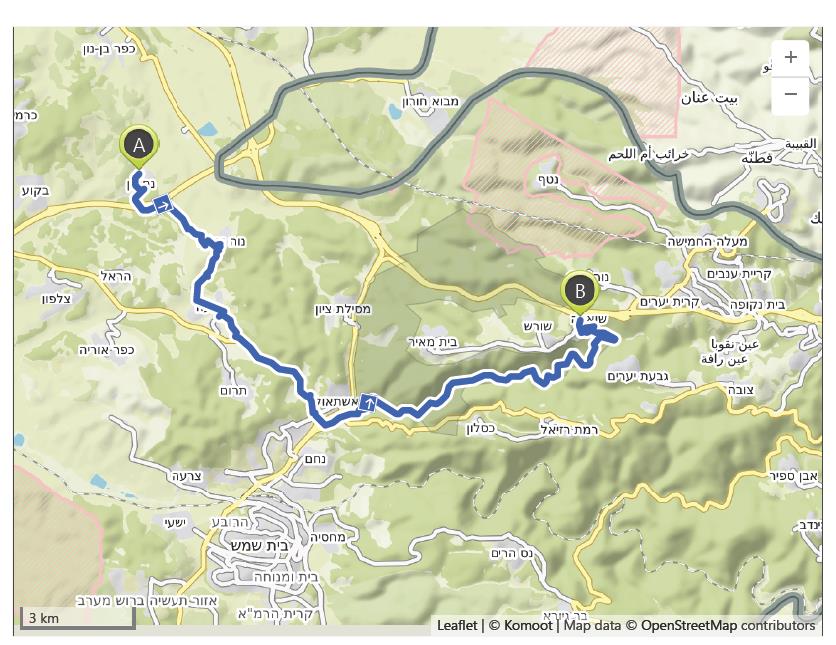
Nashon to Neve Illan – 28th October
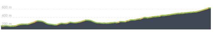
Distance: 24.6 km – Elevation +660 m -230 m
Weather: Sunny. Temperature: High 26 degrees
The kibbutz at Nahshon was founded in 1950 by immigrants who were members of the Socialist Zionist youth movement, Hashomer Hatzair. I slept well and rose early knowing that Shaikoo had to leave for his work in Tel Aviv. So after breakfast I thanked Shaikoo for his hospitality and started walking just before 7.00 am. I had planned a route which would take me to Neve Ilan, a walk of 24 kilometres that would leave me with just 20 kilometres for my final walk into Jerusalem.
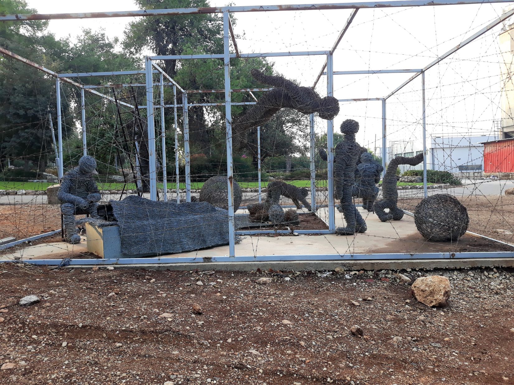
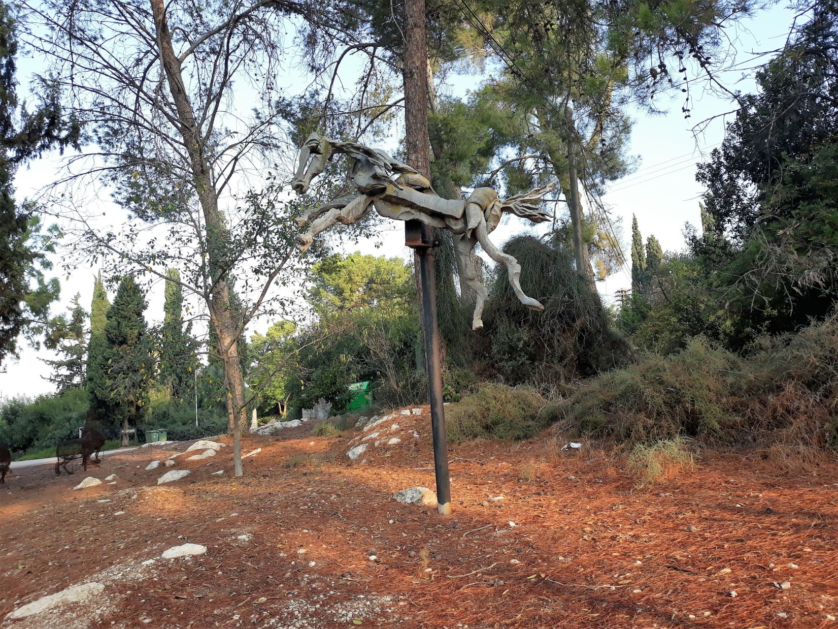
The village despite its population of close to 600 was very quiet as I left and I saw the kibbutz in daylight for the first time. The path out of Nahshon passed through a sculpture garden with several sculptures in various forms, first was a wired cage full of wired humans in various poses which had been created out of barbed wire fences by local sculptor, Michael Troper, this was followed by a metal flying horse mounted on a tree created by artist and sculptor Shoshana Lew and finally a sculpture in stone of a pregnant woman by sculptor Hagai Baz. As I left the village a passing car slowed and the driver, the young man who had helped me find Shaikoo’s place the previous evening, waved and shouted “good luck”.
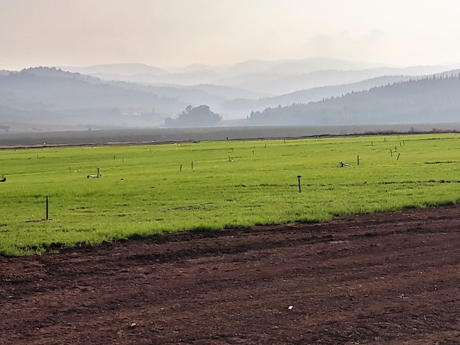
It was not long before I found myself in the open countryside of the Ayalon Valley looking across newly ploughed fields, some with the fresh green of a recently planted crop beginning to show above the brown of the earth. Beyond the fields were the Judean mountains shrouded in early morning mist,the view was magical. I could see Latrun in the distance which is close to the Roman village Emmaus Nicopolis, one of the locations associated with the Emmaus of the New Testament where Jesus appeared after his resurrection.
The valley was at peace as I stood and watched farm workers with their tractors tending the fertile soil of this beautiful valley, and it was hard to imagine the battles and wars that had been fought here since biblical times. It is where Joshua after defeating the Kings of the Amorites at Gibeon chased them through the Beth-horon pass into the valley and where he asked God to lengthen the day so that he could complete the rout of the Amorite armies ” “Sun, stand still over Gibeon, and you, moon, over the Valley of Aijalon.” (Josua 10:11 – 14). It is also the location of fierce battles during the 1948 Arab Israili war, so little has changed in the ages of time since Joshua.
The path led me to my first climb of the day to the hilltop village of Neve Shalom. Also known as Wāħat as-Salāmin (Oasis of Peace) the village was founded in 1970 by Fr. Bruno Hussar on land leased from the Latrun Monastery. It is a cooperative village and its residents are both Israeli Jews and Arabs who work and manage the village together. It was created to demonstrate that both Jews and Arabs could exist and live together in close harmony.
In total contrast to the principles that created Neve Shalom the path led me to the ruins of Bayt Susin a once thriving Palestinian Arab village. The village which had a population of 240 was captured, depopulated and bulldozed by the Israeli 7th Brigade in 1948. It was here in 1948 that the Israeli army found a way to bypass the main Jerusalem road and thus provide relief to Jerusalem blockaded by the Arabs, A sign in Hebrew close to the site translates as
” Burma Road – Susin House Springs. On May 28, 1948, the fighters of the 7th Brigade, including the Palmach Harel fighters, captured the nearby village of Beit Sosin. Thus, the distance between the fighters of the “7th Brigade” and the fighters of the “Palmach Harel” at the Sha’ar HaGai checkpoints was reduced to about four kilometers in an area where there were no enemy complexes. This situation led the fighters of the two brigades to try and find a detour to the main road to Jerusalem, which was blocked by the Jordanian army in the Latrun complexes. During the night of May 29-30, 1948, two jeeps with fighters from the Palmach Harel Brigade met here. Immediately afterwards, work began on paving the bypass road – the “Burma Road”.
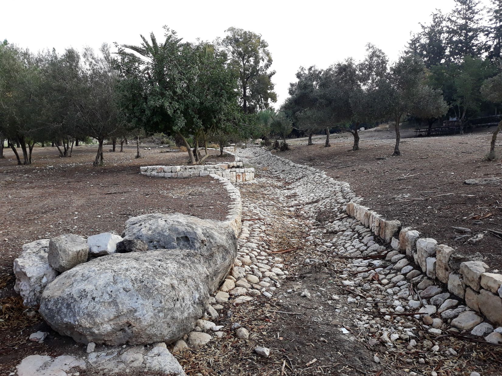
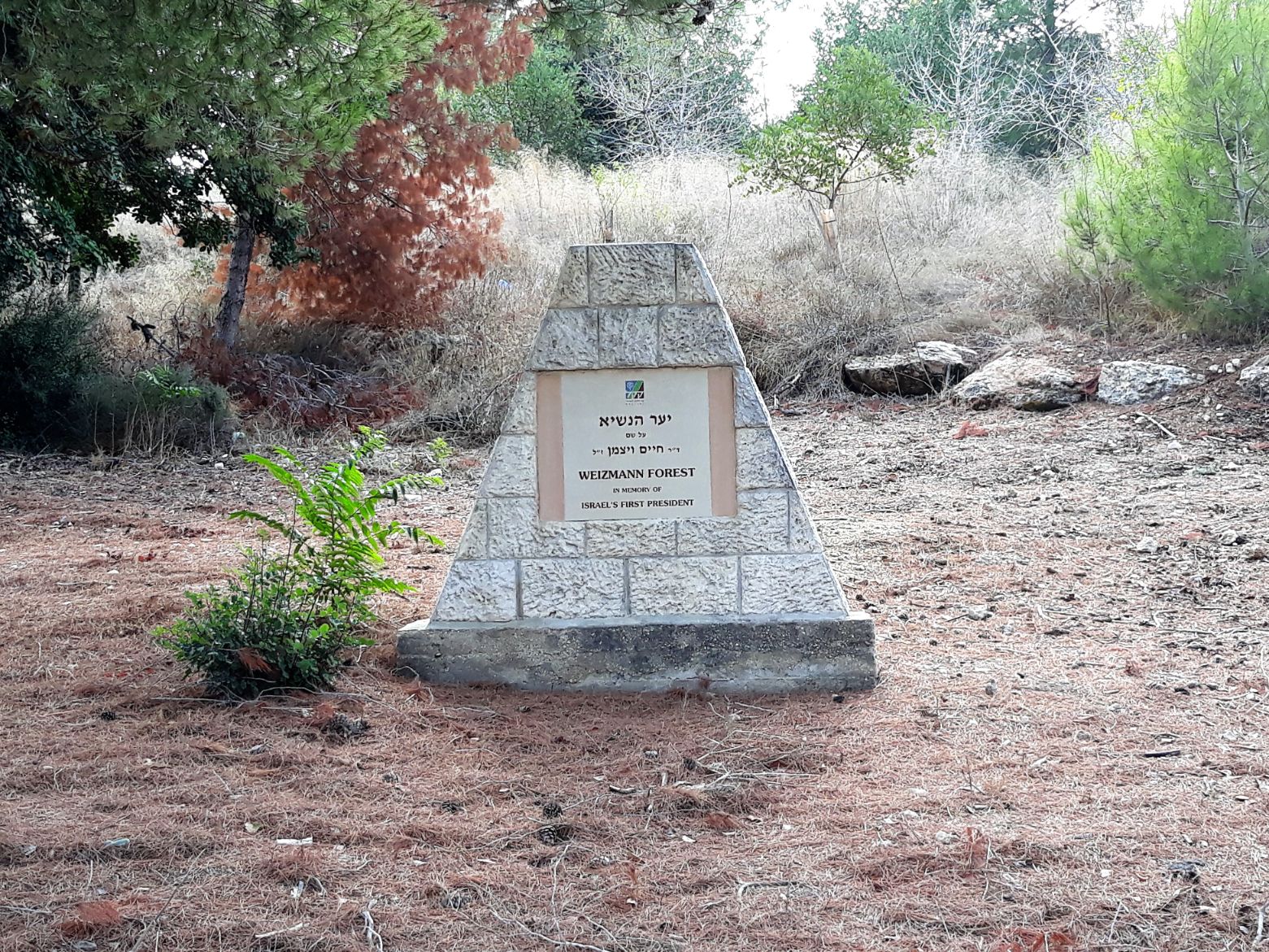
Just a kilometre south of Bayt Susin I came to the moshav of Ta’oz. The moshav was founded in 1950 and it’s inhabitants now farm the lands once owned by the Arab families of Bayt Susin. From Ta’oz the track began a gradual climb and soon after left the open countryside to run parallel with Highway 44. It was late morning and temperatures were close to 30 degrees when I reached the entrance to the President’s Forest; there I found a small seated shelter where I was able to rest and enjoy the last of the food I had been given by the shopkeeper in Nahshon. The President’s Forest is part of the much larger Tzora Forest and is dedicated to Chaim Weizmann, the first President of the State of Israel. Located in the Judean highlands it has a sculpture trail that winds its way through the forest planted with trees of terebinth, pine and carob. It is also the location of Tel Tzora, the biblical village of Zorah and the birth place of Samson the Israelite warrior and judge. (Judges 13-16).
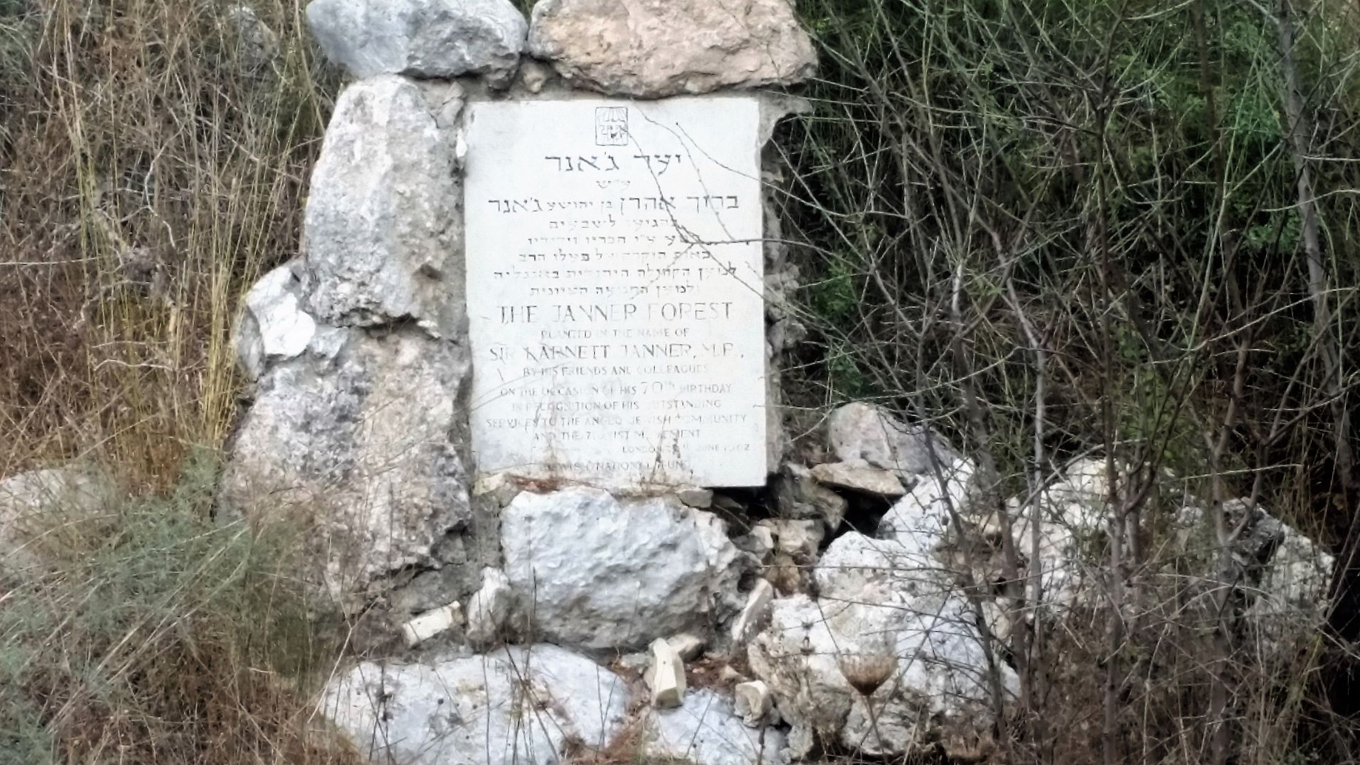
Just as I was preparing myself to leave, a forest ranger drove past, stopped and asked if I needed any help. After explaining about my onward journey I asked if there was a source of water close by at which point he took my almost empty water bottle and filled it with water from a tank he had mounted on his land rover, wished me luck and drove away. I continued to follow highway 44 as it ran through the forested Judean Highlands passing a stone pillar with the inscription ” A wood named for Sir Barnett Janner, member of the British Parliament and president of the Board of Deputies of British Jews, was dedicated today near Aminadav in the Jerusalem Hills in the presence of Sir Barnett and other members of a delegation of Anglo-Jewish leaders currently on a study tour of Israel.” The Janner Wood was created in 1963 within the larger Bar Kochba Forest.
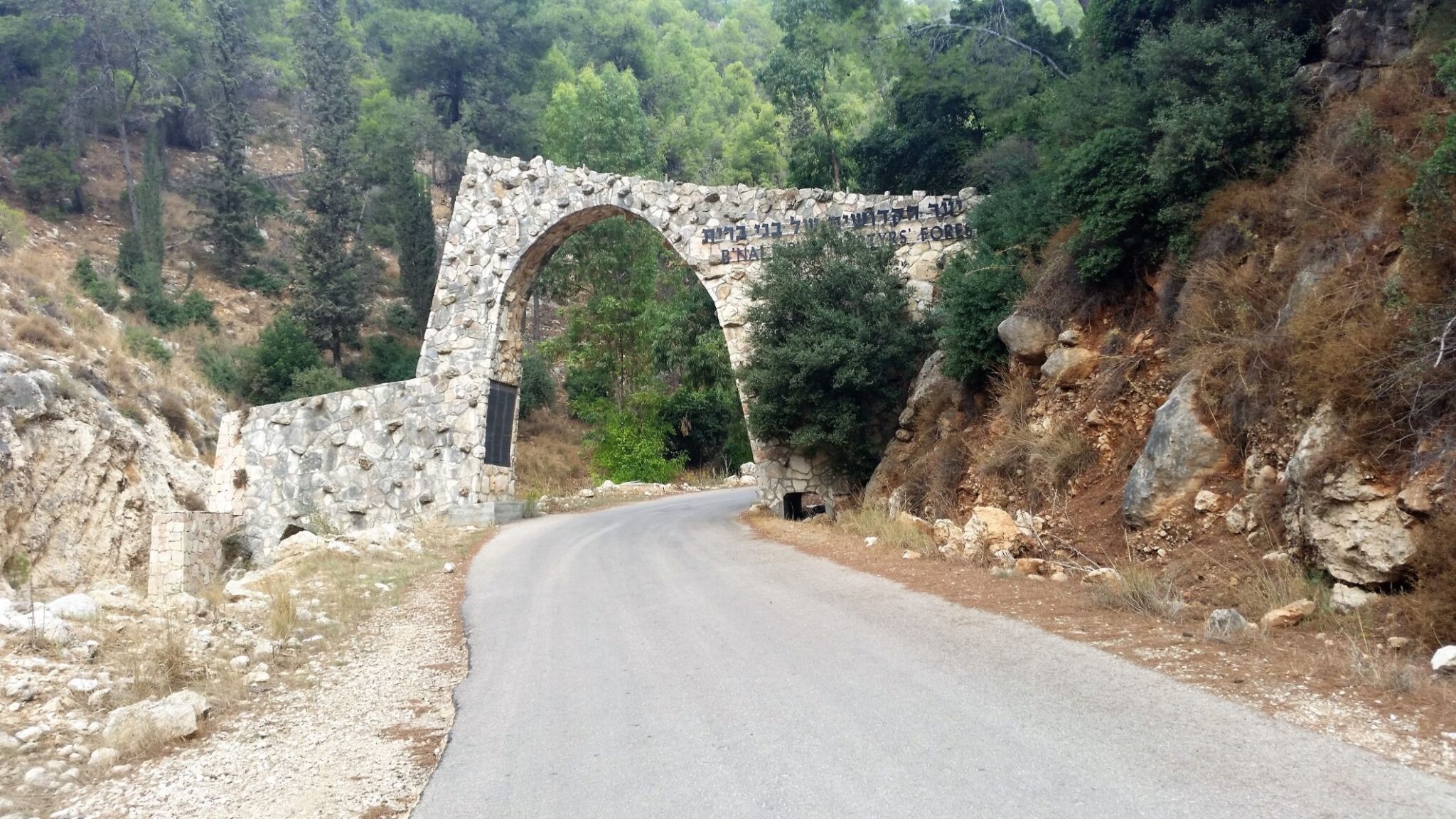
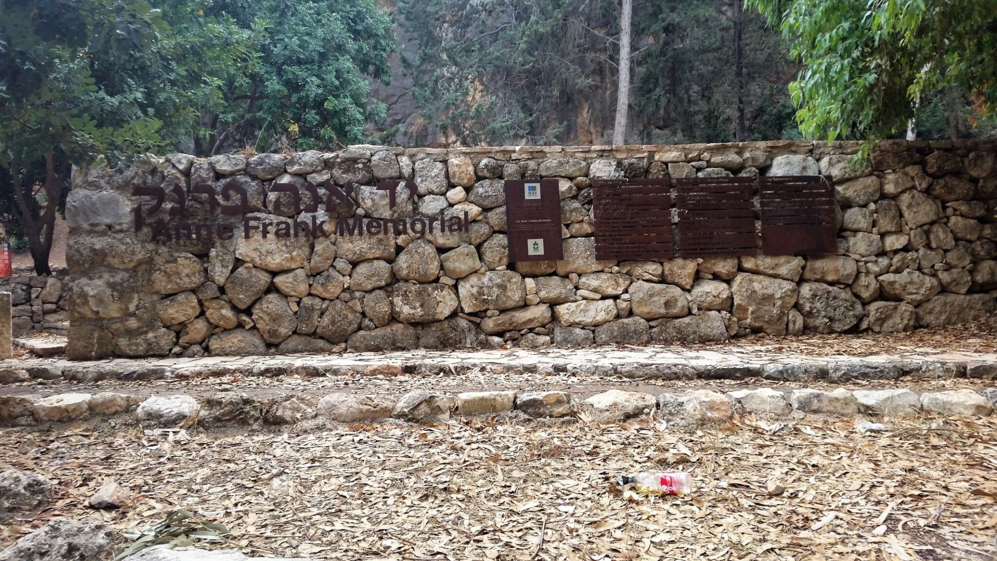
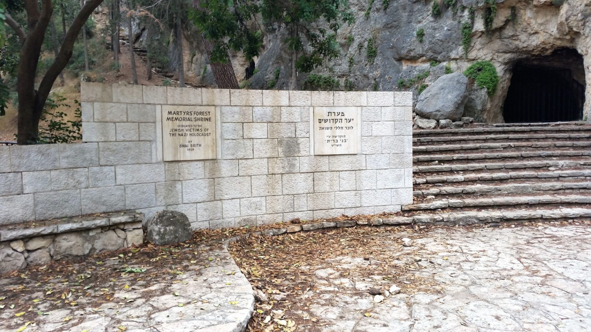
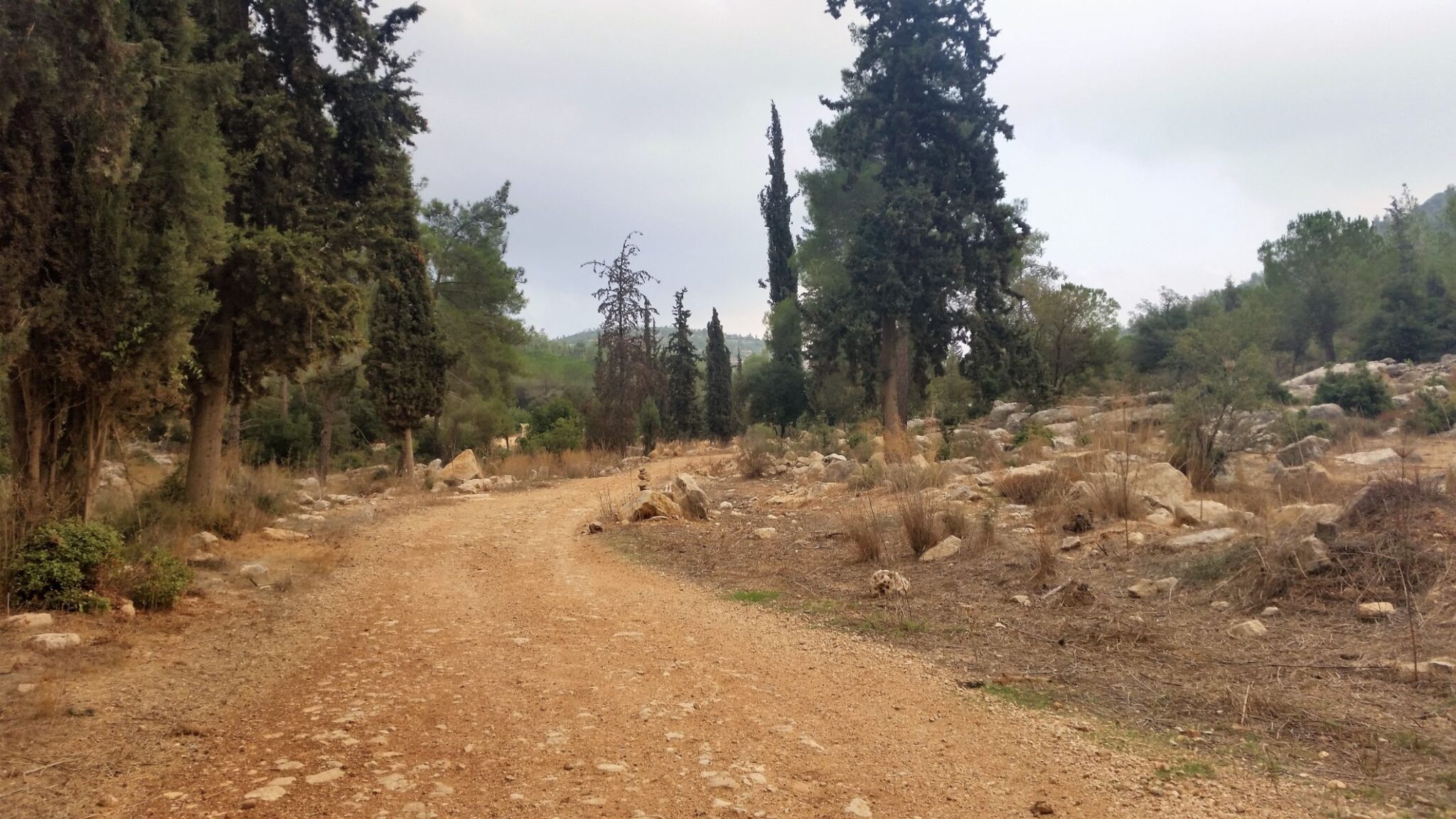
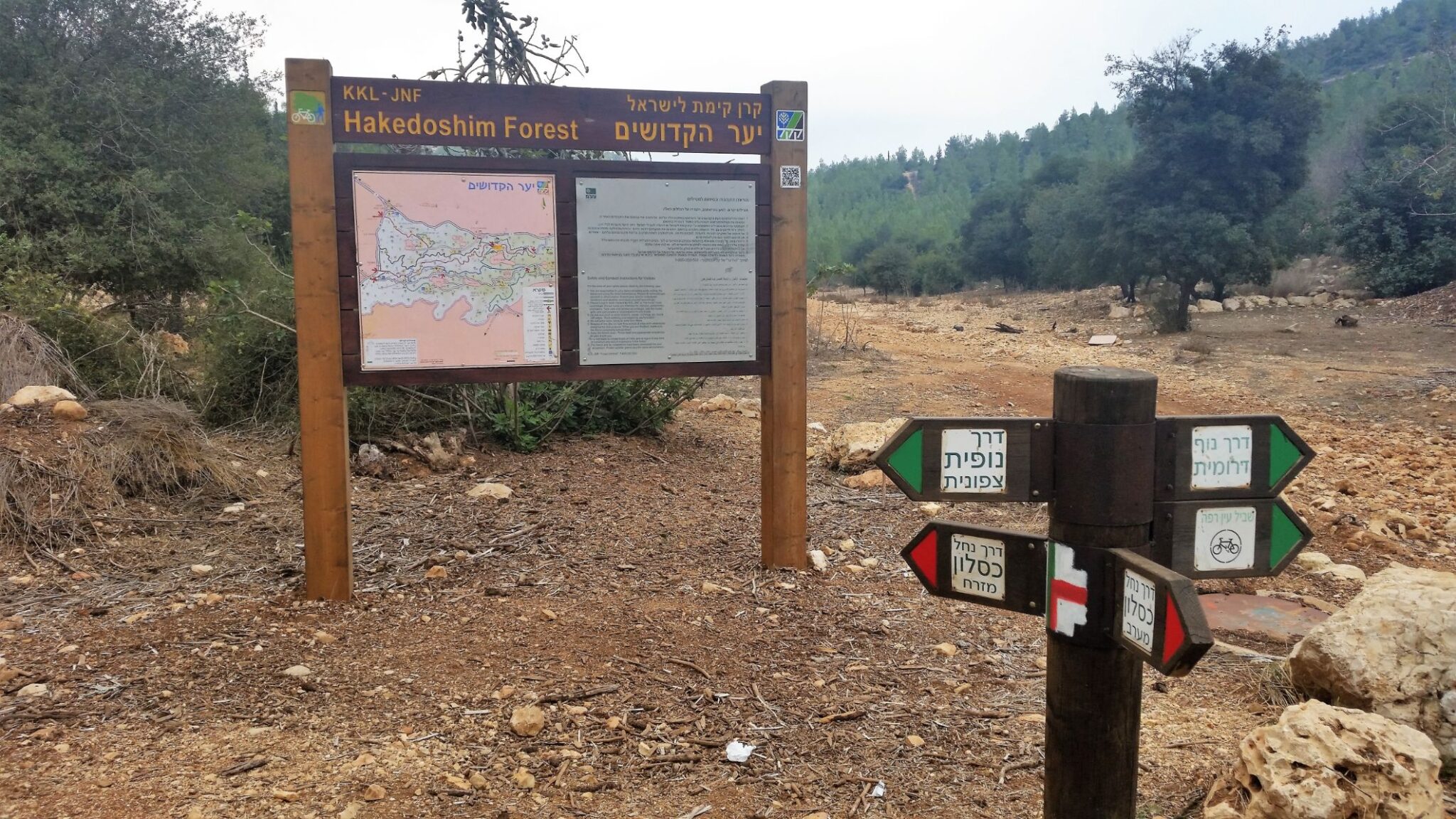
Later I came to the Hakdomish Forest where I stopped by the Wadi Kisalon for a rest and snacks from my backpack. The trail continued a gradual climb following the Wadi Kisalon and in the distance I could see a large stone built arch which when I approached an inscription told me it was the entrance to the Martyrs Forest. The forest was planted with six million trees in 1951 to commemorate the victims of the Holocaust. The trail passed beneath the arch and on through the now mature forest of pine, cypress, eucalyptus, carob, kermes oak, and terebinth to reach, nestled at the foot of Mount Carmila, the B’nai B’rith cave (Martyrs Cave) which is where visitors can sit and reflect. Close by is a memorial to Anne Frank built in 2011 to commemorate Anne Frank and the chestnut tree which she could see from her hideout and mentioned in her diary. The monument was designed y Dutch Jewish sculptor, Holocaust survivor Piet Cohen after the chestnut tree had fallen in 2010. I sat and reflected for a while on the horrors inflicted by the human race on its own kind before starting the climb through the forest and the Judean Mountains National Park to the Moshav Sho’eva. It was a beautiful walk on this the penultimate day of my pilgrimage, tomorrow I would reach Jerusalem.