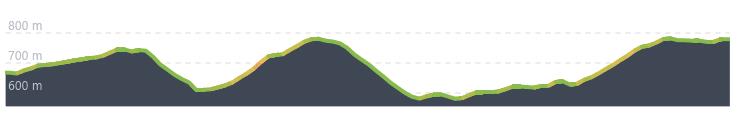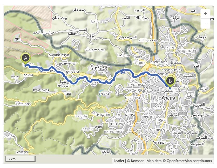
Neve Illan to Jerusalem – 29th October
Distance: 20.2 km – Elevation +490 m -380 m
Weather: Sunny. Temperature: High 25 degrees
Situated in the Judean Hills at an elevation of 700 metres, the Neve Ilan Kibbutz Outpost was founded in October 1946 on land purchased from a local Arab by the Jewish Natonal Fund. The primary aim was to create an outpost to protect the main and only route into Jerusalem that ran through the Ayalon Valley below, Surrounded by numerous Arab villages the Kibbutz was built by Holocaust survivors and veterans of the French Maquis resistance movement who had recently arrived from Europe.
The strategic importance of the hill on which the outpost was constructed was also noted over 2000 years ago when a fortress was built during the reign of the Hasmonean king Alexander Jannaeus. It was later modified by King Herod during first century BCE.
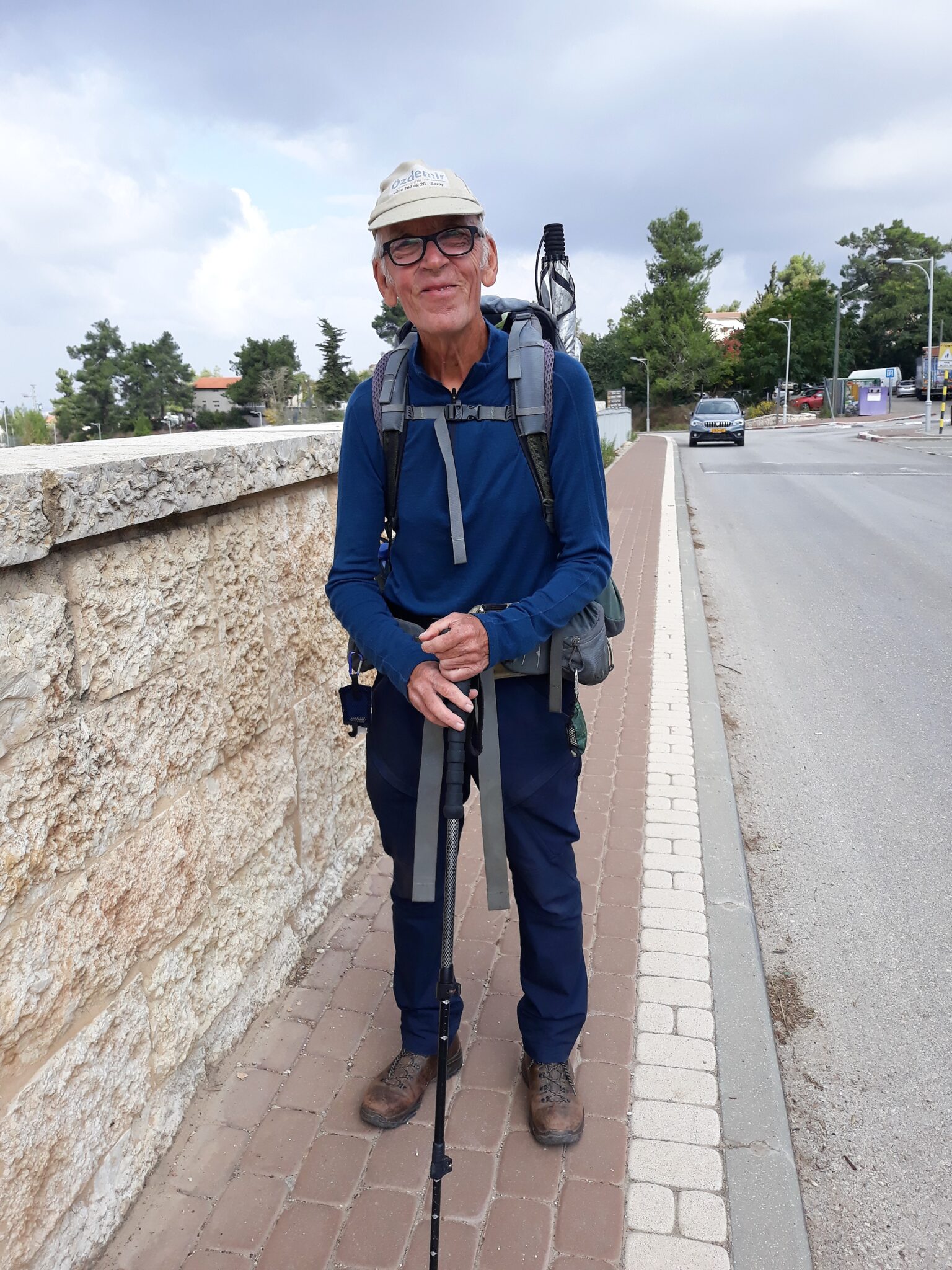
Today, Neve Ilan is a moshav shitufi, which in terms of the principles of cooperation of it’s residents is a mix between those of a moshav and a kibbutz. I stayed last night in the most expensive place since I left Rome. The hotel was the only option available and the cost would have paid for twelve nights in Turkey! I had just 20 kilometres left to reach Jerusalem so I enjoyed a leisurely breakfast before setting out at 9.00 am to walk the final day of my pilgrimage.
I had only just started walking when a car stopped and the driver asked where I was going and after listening to my explanation he asked if he could take a few photos. His name was Joseph and we talked for around thirty minutes about many things. He told me he was an artist and showed me photos of his paintings. He said he wanted to tell his sons about my pilgrimage and hugged me on leaving.
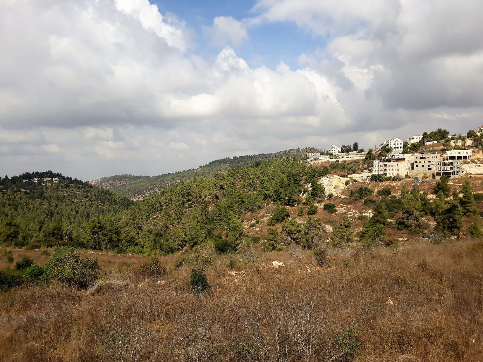
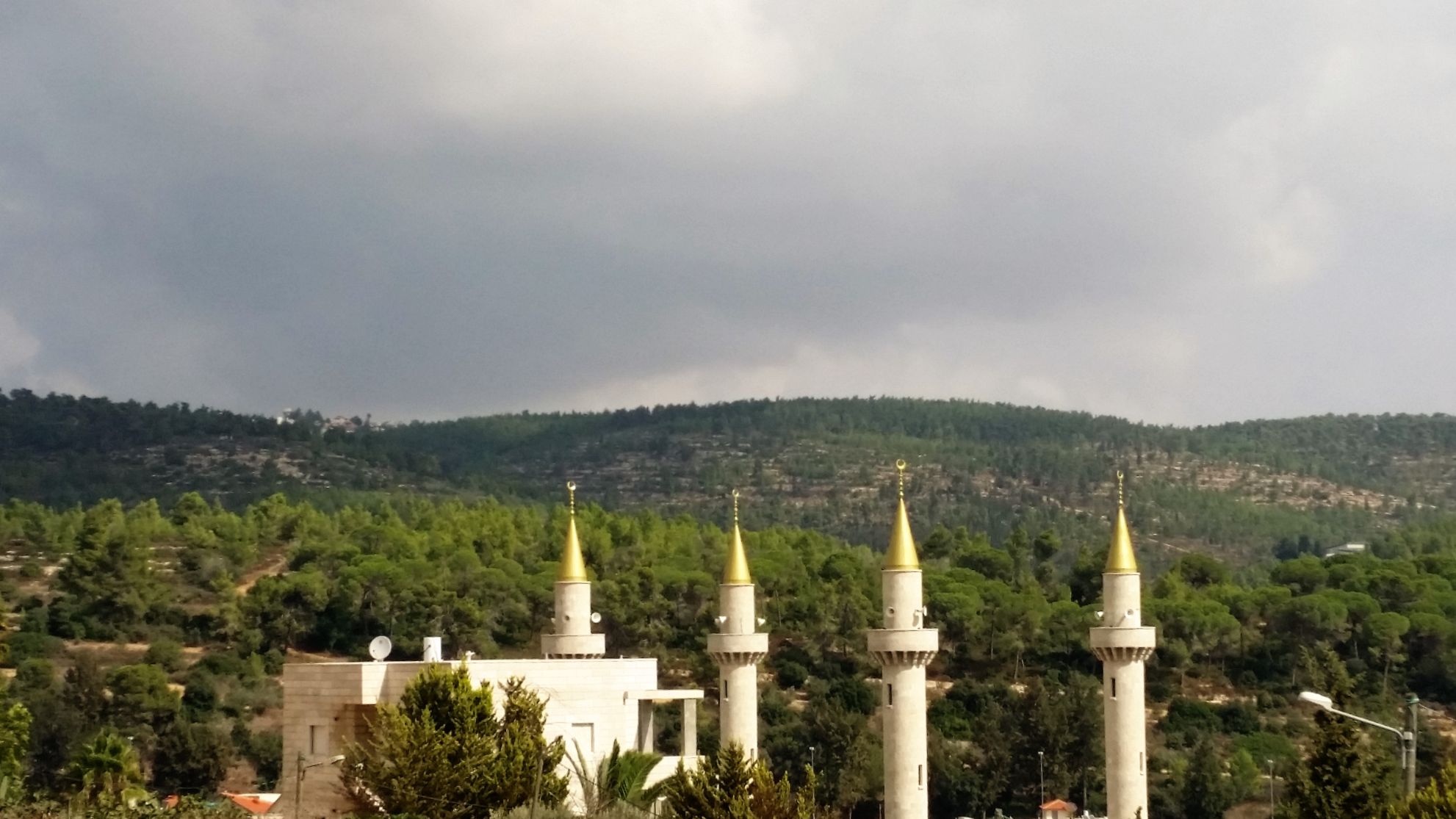
After leaving Joseph there was a gentle climb of around 4 kilometres with beautiful panoramic views of the Jerusalem Hills before reaching Abu Ghosh. Abu Ghosh stands approximately 750 metres above sea level and is probably the location of the biblical city of Kiriath-jearim where it is mentioned that the Ark of the Covenant was kept before being moved to jerusalem. Looking out across the town I could see the four golden tipped minarets of the Akhmad Kadyrov Mosque in the town center. Completed in 2014, it is the largest mosque in Israel; the construction was funded by donations from the Chechen government.
From the hilltop of Abu Ghosh the path descended to the En Hemed National Park with its ruins of a Crusader castle and farm, before starting to climb to Castel National park. Located at an elevation of 780 metres the park was the second highest point of todays’s walk. It is the site of now depopulated Palestinian village of Al-Qastal. It has been a strategic hill top location since the Romans first built a castle here, upon the ruins of which a Crusader castle was built. It was the site of a major battle during the 1948 Arab Israeli war.
Before starting my final descent of the day I stopped for lunch in a small cafe in Mevaseret Zion where I sat on the terrace watching the daily life of the local residents, none of whom seemed to notice me, none of whom knew that I was a pilgrim on my way to Jerusalem, none of whom knew that I had been walking for five months passing through eight countries covering a distance of 4500 kilometres. It wasn’t important that they didn’t know because in just a few hours I will be in Jerusalem.
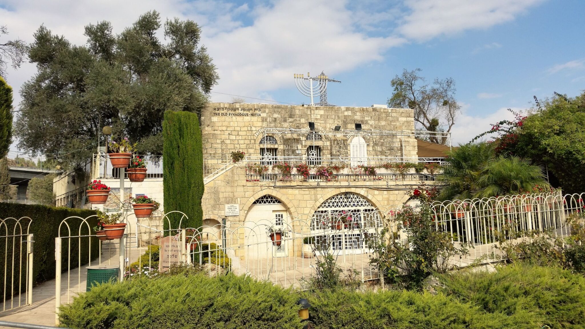
After the lunch break the path descended to Motza where I passed by the old synagogue. This was originally the Yellin House built as a travelers inn in 1871, on the ruins of a Byzantine structure. It was converted to a synagogue in 1905 and existed as such until the Palenstian riots of 1929. It was renovated in 2006 by the Society for Preservation of Israel Heritage Sites.
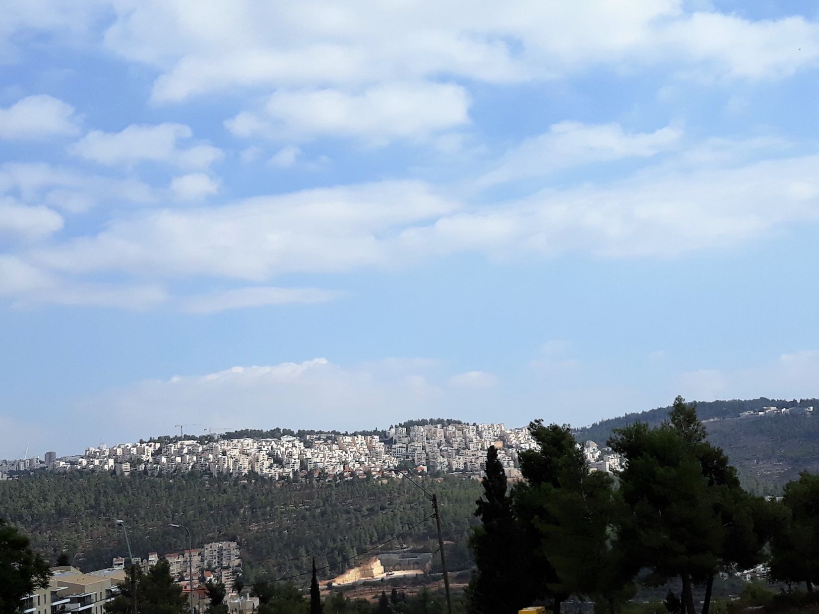
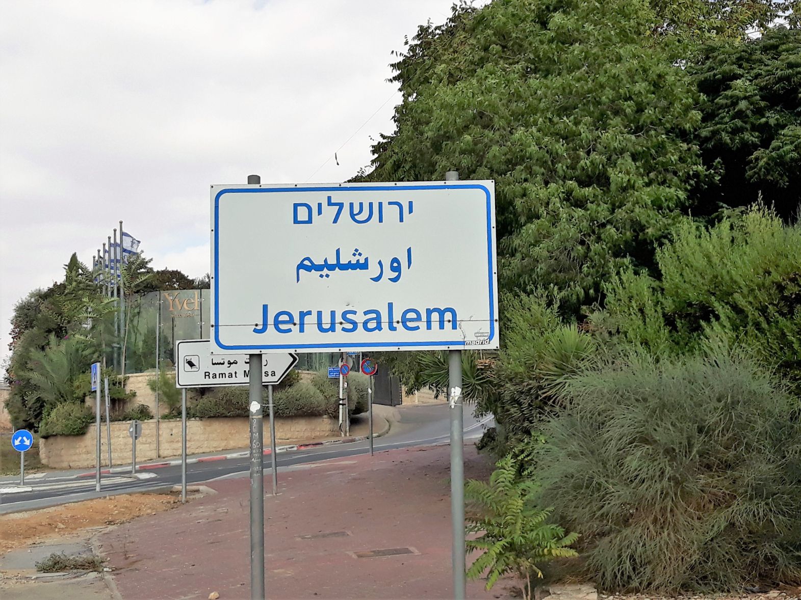
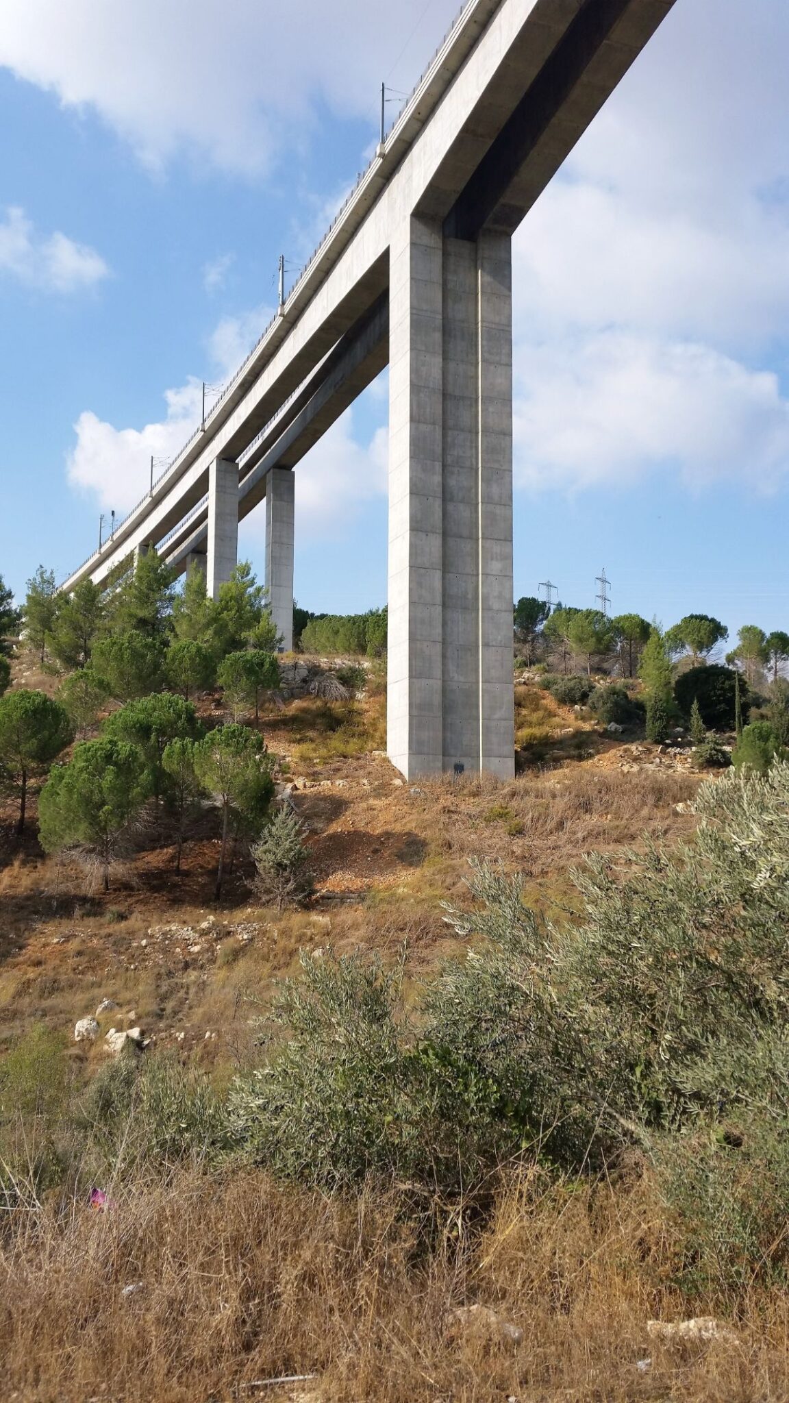
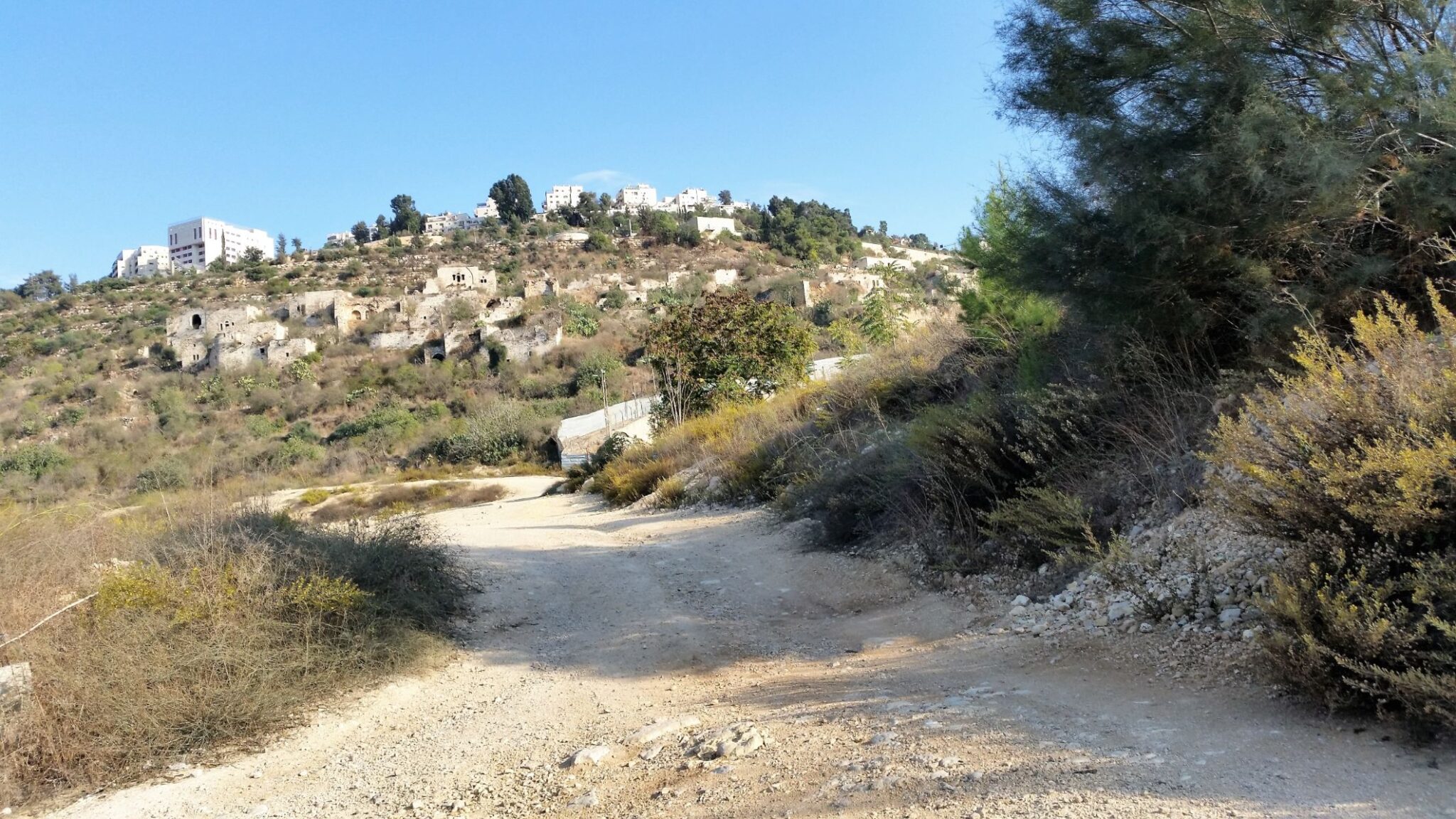
I came to my first sighting of a “Jerusalem ” sign when I reached the boundary of Greater Jerusalem at 1.30pm and was still 8 kilometres from my destination. Soon after I entered the Arazim Valley Jerusalem Park, part of a green belt that in almost circles Jerusalem. The Arazim Valley is a tributary of the Nahal Sorek, a drainage basin that provides a natural entrance way from the coastal plain into the Judean hills and Jerusalem. I followed the cycle path through woodlands, orchards and vineyards and walked beneath the impressive high-speed rail bridge. Completed in 2017 it links Jerusalem with Tel Aviv. As I continued to walk I saw on a hillside in the distance what appeared to be a small village with a cluster of white flat topped buildings, As the path drew me closer I could see the village was overgrown and deserted. This was the once Palestinian village of Lifta that had been depopulated during the 1948 Arab Israili war. In 1945 this once beautiful village had an Arab population of 2250. There are only 55 of the original 400 houses still standing. It is a special location with a history going back to Canaanite times and during biblical and Roman times the village was known as Nephtoahon on the border between the Israelite tribes of Judah and Benjamin. The Byzantines called it Nephtho, and the Crusaders referred to the village as Clepsta. So before its depopulation in 1948, the village had been continuously inhabited for well over 2,000 years. Some call it the Palestinian ‘Pompeii’ and there is a constant battle between conservationists who wish the village to remain and developers who wish to destroy the existing houses in order to construct luxury villas in their place.
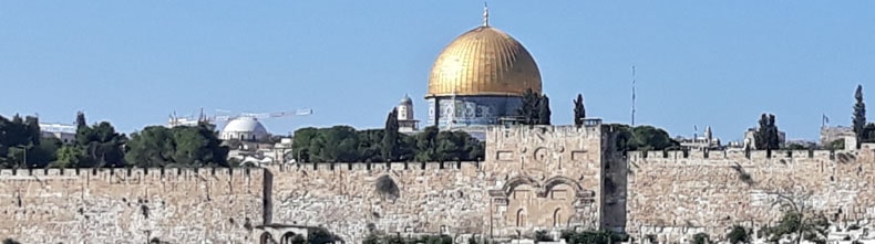
After passing by Lifta the path continued its climb to Western Jerusalem and as I climbed my thoughts turned to the Songs of Ascent that pilgrims would sing as they also climbed into Jerusalem, especially the words of Psalm 122 “I rejoiced with those who said to me, “Let us go to the house of the Lord.” Our feet are standing in your gates, Jerusalem.” and soon I also would be at the gates of Jerusalem.
From the sanctuary of the park I arrived at the Golda Me’ir Boulevard and then into Shmuel HaNavi Street where the tomb of Samuel the prophet can be found , and after whom the street is named. This strictly orthodox neighbourhood of Haredi Jews was very busy and I felt a little out of place and conspicuous as I quickly weaved my way past the men in their large brimmed hats and long black coats, with long curls at each side of their face.
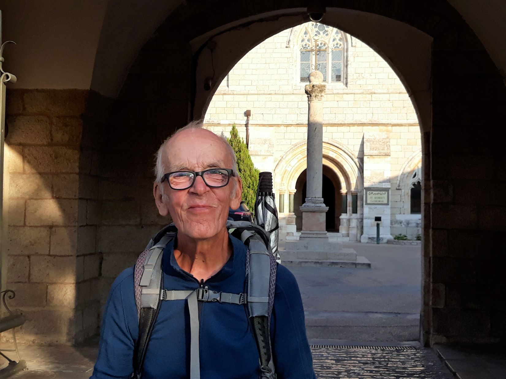
I was very close now and soon after passing the American Colony Hotel I arrived at my final destination, the Cathedral Church of St. George the Martyr, where I had arranged to stay during my time in Jerusalem. I was met by the Dean of the Cathedral, Reverend Hosam Naoum and we prayed together in the Cathedral to give thanks for my safe arrival in Jerusalem.